|
Revised
7 March 2001 - Davis Fields
Comments
and suggestions are welcome! Please send them to davis@fields.net.
Thank
you!
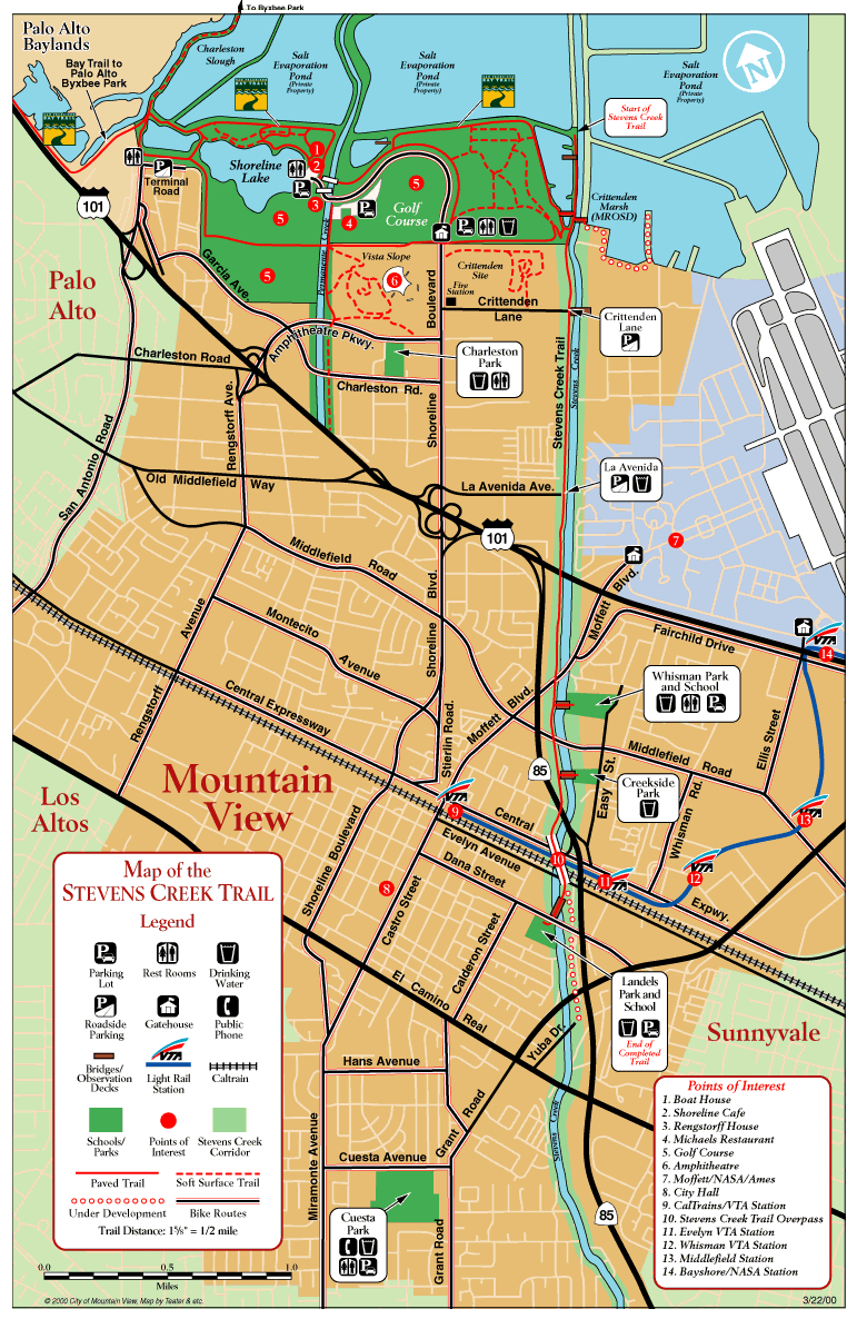
Learn
more about "Reach 4" of the Trail.
Reach
4 Segment 1
is under development and will extend the Trail southward from
Landels School to Yuba Drive (as indicated on the map below).
Reach
4 Segment 2
is still being planned, extending the Trail south from Yuba Drive
past El Camino Real south to Mountain View High School (just
off the bottom of this map).
|